Showing posts with label advanced. Show all posts

Monday, October 22, 2012

FRYINGPAN RIVER Upper Pan

Put-inNorrie Colony           
Takeout    Bridge
Length3 miles (6 miles to Reudi)
Difficulty<300 cfsIV+
300-600 cfsV-
> 600 cfsV

Special Beta:            Long drive but high-quality IV+/V– creeking. Watch for logs.

Fun Factor:
Fear Factor:

Here is a personal favorite that lies high up in the beautiful valley above Reudi Reservoir. These upper reaches of the Fryingpan are nestled in a lush alpine setting of tall pines, rounded glacial boulders, and clear cold water. The whitewater is technical but not overly threatening, and you will almost surely have the river all to yourself.

There are some drawbacks, however, to this special Colorado whitewater experience. Getting to these waters requires a substantial bit of traveling. Even if you are holed up in Basalt, the nearest town to the Upper Pan, it will take nearly an hour of driving time just to get to the put-in. The other factor that really pulls this run’s teeth is the diversion that sucks Fryingpan River water over into the Arkansas basin for agricultural use. As part of the Hunter-Fryingpan Project, the Pan is partially de-watered much like the Upper Roaring Fork and boasts only a shadow of what must have been its former glory. Despite these drawbacks, the Upper Pan is an area classic at the grade and a run that is well worth its trouble.

Below the put-in bridge you enter a series of technical pool-drop rapids of a IV to IV+ nature. Quickly you discover the nature of this run: fast, technical, and loaded with potential pin spots. Though the rocks are generally rounded and forgiving, wood can manifest in particularly heinous ways. Careful boat scouting can help you avoid the worst of it, but beware of nasty, surprising placements.

About halfway down the upper section the North Fork of the Fryingpan comes in on the right, sometimes doubling the flow. The rapids become even more continuous below here. Though most of the drops are indistinct and run head on into the next, there is one particular spot on a left bend not far above the bridge that is probably the crux of the run.

Below this rapid the river goes down a straight stretch and bends right underneath a bridge (about three miles in the run). Most people nowadays takeout here. Some good class III-IV whitewater, however, still exists between here and the headwaters of the Reudi Reservoir where there is another excellent takeout. After all the driving, I would recommend either getting out at the bridge and driving back up to repeat on the cheddah, or continuing on down through more mellow boating to the lake and basking in the scene.

Getting There

 From Basalt take FR 105 27.5 miles past Reudi Reservoir on Fryingpan Road to the town of Norrie Colony. Pass the dam at mile 13.7 and the bridge at the inlet for the lake (possible takeout) at mile 21.8. Reach another bridge at mile 24.6. This is the takeout for the upper section only. Continue 2.7 miles further to Norrie Colony where you can park in a pull-out in a meadow. Hike to the creek and put-in anywhere downstream of a bridge.


Friday, August 17, 2012

FRYINGPAN RIVER Lower Pan

Put-inSeven Castles            
Takeout    Basalt 
Length7 miles
Difficulty250-500 cfsIV-
500-1,000 cfsIV
> 1,000 cfsIV+


Special Beta: Good intro to creek boating, but beware of wood!

Fun Factor:
Fear Factor:

The Lower Pan is an excellent off-the-beaten path run with beautiful scenery, easy access, and surprising high-class whitewater. Though meager releases from Reudi Reservoir often choke the life right out of the Lower Pan, I rarely miss an opportunity to paddle this section when the water level rises.

Driving up from Basalt to the put-in you will be able to see much of this run. Beware, however, of spots where the river lies away from the road, as this run does have a way of accumulating some gnarly log placements. The crux rapid, just below a pull-out 2/3rds of the way through the run, is partially visible from the road, but you must use the pullout to see it all. This rapid is long and a bit technical and swimming anywhere on this creek is ill-advised. I have seen swamped kayaks lost here.

The slide just below the put-in
The usual put-in is just above an obvious slide that is clearly visible from the road. There is a good pull-off here to park your car and gear up. Though the slide looks big from the road, it paddles fairly easy. Dodge a hole at the top and stay upright and you will be fine (III+/IV-). A couple of quick, semi-technical rapids come in quick succession. Beware of log placements in these tight, bony drops. Not far downstream the river enters a zone where a large mudslide five-ten years ago completely re-channeled the river. Now the creek has been diverted into a grove of trees. Beware of strainers here until the stream is able to re-establish its channel.

A long stretch of II-III whitewater follows with fun turns and good eddies. Always be alert for possible strainers. After a couple of miles the river mellows out and you pass some very beautiful homes along the riverbanks. There is a possible river access on the right at a large right-hand meander. As you come out of this turn you enter the crux rapid.

You come around a right-hand turn and the rapid will come into view. It is a good idea to eddy out here. This rapid is probably best pre-scouted from the pullout as you run the shuttle, and might be worth a look for those uncomfortable with class IV. Though the rapid itself is only IV- (except possibly at high water when it is more difficult) the bony streambed makes for gnarly consequences in the event of catastrophe. The river drops down a straightforward chute with large waves then bends left and tumbles through a series of small ledges and holes. A pinrock here or there spices things further. Things taper slowly but remain vigorous for a few corners before mellowing. A sharp drop just as the canyon opens up and you start to enter Basalt, however, can spank you if you are off-guard. This rapid is particularly treacherous at high water (III+/IV).

The Pan mellows as it rolls through Basalt. The takeout at 7-11 in on river left just below the river empties into the Roaring Fork.
GETTING THERE

The takeout is in Basalt just off Highway 82 at a dirt boat ramp next to the 7-11 store. To reach the put-in, head upstream on the Fryingpan Road 4.2 miles from Basalt towards Reudi Reservoir at a dirt pullout next to an obvious slide rapid. The pull-out next to the crux rapid is found 1.8 miles up Fryingpan from the 4-way intersection with Two Rivers Road.

Monday, October 17, 2011

COLORADO RIVER Shoshone

Put-inShoshone Powerplant            
Takeout    Grizzly Creek
Length1.6 miles
Difficulty< 2,000 cfsIII
2,000-5,000 cfsIII+
5,000-10,000 cfsIV
> 10,000 cfsIV+
Special Beta: Colorado big water with roadside access!

Fun Factor:
Fear Factor:

At regular levels Shoshone is one of Colorado’s benchmark class III runs. Seen by millions and paddled by many, Shoshone is one of the busiest stretches of river in the state. Very few, however, would likely call Shoshone their favorite.
         
As a long-time local paddler who has paddle Shoshone more times that I could ever count and at almost every level between 400 and 10,000 cfs, I have a certain fondness for this run; it is where I honed many of my skills. Shoshone does, however, have a few detractors that keep it from being a classic. First, length. At just over a mile and half, Shoshone is simply too short. Second, visibility. With a bikepath, train tracks, and a four-lane interstate, it is often hard to remember how amazing and beautiful Glenwood Canyon is. The noise pollution is tremendous. Third, this run is busy. Hoards of boats do Shoshone and the sheer volume of rafts and kayaks can change the nature of your day. Shoshone does have some things going for it, however, that make up for some of its shortcomings. It has deep, quality class III whitewater with ample opportunities for play (though none too amazing). It has consistent flows that keep it running when all else has gone dry. It is a great place for the skill-advancing intermediate to sharpen their kayaking teeth and learn skills necessary for more technical whitewater. These factors alone will always guarantee this run’s
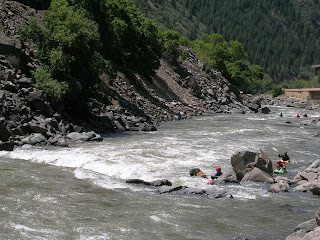
Shoshone on the Colorado River
The All Day Wave on Shoshone
popularity.

After putting in at the boat ramp below Shoshone Powerplant, you paddle a short riffle (II) to a huge eddy on river right above the first rapid, Baptism (III-/III+). Before I get into describing the rapids themselves, it is worth noting a fact or two about said rapids’ names.

The name game in Shoshone is a complete mess. While each of the rapids, and even some of the individual holes, rocks and even eddies, have been named, there seems to be a great deal of confusion about these names. Kayakers might call a rapid one thing and rafters might call the same drop by yet another moniker. Certain rapids might have two or more differing names depending on who you talk to. This first rapid, for example, is usually called Baptism (III-/III+), but I have also heard it called Upper Superstition in certain guidebooks. Oh well, I will try to note this discrepancies as I go along.

Baptism is a straightforward rapid with a large wave train at the top that widens into runnout that is peppered by holes or rocks depending on the level. This rapid merges into the next at medium and high levels.

The river bends hard right below Baptism and enters Tuttle’s Tumble (III/IV), which I have also heard called Lower Superstition. Tuttle’s features a large table rock in the center of the river that forms a big and trashy hole above 4,500 cfs or so. A river-right chute is the usual route around this obstacle. Move either left or right below Tuttle’s to avoid two off-set rocks at low water (the Olsen Twins) which turn into a huge, trashy hole at higher levels (Marty’s Diner). Immediately below Marty’s is a rocky runnout called Pinball Alley (II+/III) with a few sharp moves around small but troublesome rocks/holes. A big eddy on the left below provides a good place to stop before the next rapid.

Next up is The Wall (III/IV) one of the more distinct and fun rapids of the run. While almost everyone agrees that this rapid is called The Wall (named for a retaining wall on river left) I have seen it listed as China Wall in several publications. The river bends right through The Wall and crashed through a series of big waves and holes. Most boats enter left to miss two ledgy holes and pull right to miss a rock/hole at bottom-left of the drop. The slot between the two holes at the top is also a common gate for entry and shortens the pull right, making it especially popular for heavy rafts. Many rafts have flipped, however, flubbing this entry move and dropping into either of the two holes. Above 4,000 cfs these holes are powerful. Above 8,000 cfs they are basically washed out.

Below The Wall is a large eddy on river left followed by a short drop that forms a surf wave at lower levels. This drop is often called the All-Day Wave by kayakers, a named from a different era that seems almost comical now. In the days of the 8-foot playboat we used to front surf/flat spin here for hours. Nowadays it’s probably only good for a carve or two before moving on. I have heard this rapid called Bonehead and even, ugh, Upper Superstition in certain circles. This short class II is washed out above 3,000 cfs.

Below the All-Day Wave the river constricts and bends slightly left through a short rapid sometimes called Lower Superstition. I prefer to think of this rapid as the first part of Tombstone, as problems here often lead to problems in Tombstone immediately downstream. At higher water the two drops are intimately connected. A huge crashing wave forms here above 4,000 cfs or so and the undercut formed by the bikepath at high water on the right is a particularly dangerous place for swimmers.
A raft on Tombstone Rapid

In my opinion, Tombstone (III+/IV) is the crux rapid of the run, and the only one where everyone seems to agree on the name. A tall, sharp rock left of center distinguishes the hardest move. This rock combine with a steep pourover/hole to its right barrs easy passage. At low water rafts generals go right of the hole and cut back left to miss a pesky pinspot. Kayakers, on the other hand, usually take a whooshing slot between the tombstone and the hole and avoid the pinspot completely. At high water you must wiggle between two very large holes. The pointed rock starts to go under at about 6,000 cfs.

After Tombstone the river calms in a large pool sometimes called Cottonmouth Alley by raft guides. At highwater the river remains fast through here. The last rapid, Maneater (III/IV) has a reputation as the run’s hardest, but in truth it's straightforward. This reputation comes from the fact that some of the biggest waves of the run are found here. Maneater is straightforward to run, however, and flushy. A flip here should deposit you in calmer water downstream, making this one of the better places to experience carnage. Busting a big wave 2/3rds of the way down keeps the commercial rafters wet and smiling. A large ledge hole far left above 5,000 cfs is probably this rapid's most dangerous hazard. Unfortunately, Maneater was listed as Superstition Rapid in Dave Eckhardt and Gordon Banks 2nd edition of Colorado Rivers and Creeks.

Below Maneater a half mile of easier water (II-) brings you to the popular Grizzly Creek boatramp.