Showing posts with label Colorado River. Show all posts

Wednesday, December 7, 2016

NEWS: Open Pit Mine Threatens Upper Colorado River

Proposed site of the gravel pit. Courtesy Gypsum Town Council
American Whitewater is reporting that a proposed open-pit mine in Eagle County along the Upper Colorado River. The proposed mine is 90 acres in size and would be directly adjacent to a rural and beautiful stretch of the Colorado River. American Whitewater is encouraging all boaters and/or interested parties to attend a town council meeting at Gypsum Town Hall on December 13th to learn more about the proposition and voice their opinion.

Here are links for more information and to take action against the proposal.

American Whitewater article about the proposition

Town of Gypsum page regarding the project (and other projects) they are considering.


Wednesday, August 17, 2016

News- Kayaker Drowns in Gore Rapid

Pyrite Falls, a short distance below where the accident took place
A kayaker has drowned in Gore Rapid, sources say, after he was ejected from his boat. The incident, which occurred on Thursday August 11, took place at Gore Rapid. The victim, who has been identified as James "Jamie" Page, a 25-year-old man from Pennsylvania, had apparently become stuck in "Ginger," the strong hole on the "meat" line of Gore Rapid and swam. This is the second fatal accident in the canyon this summer.

The first accident occurred on July 24th when 19-year-old Avon, CO resident, Patrick Kelsall apparently fell from a cliff at night near Appelsauce Rapid. Our thoughts our with friends and families of both victims.

Tuesday, July 12, 2016

VIDEO: Charlie MacArthur Whitewater SUP

One of the great paddlers of Colorado, owner of Aspen Kayak School and now whitewater SUP pioneer, Charlie MacArthur pus on a display of what stand-up paddleboards are capable of in the whitewater realm. Includes film of the Slaughterhouse section of the Roaring Fork River in Colorado, the Glenwood Springs Whitewater Park, Big Sur and more.


Thursday, November 20, 2014

VIDEO: Lava Falls Carnage

While the Grand Canyon's Lava Falls may not be "the one by which all others are measured" as it used to be, it is still, without question, one of the most famous rapids in the world. By today's standards it probably earns anywhere from a III+ to IV+ rating, making it to understand its fearsome reputation as one of the gnarliest rapids in North America. The following video, however, shows that though this rapid may have shrunk in the whitewater world's eyes, it can still deliver some serious punishment. And still, discounting that this is "just" Lava Falls, this is one of the most serious beatdowns I have ever seen in a raft. By the end, even the raft's thwarts have been ripped out. Gnarly!

Friday, August 29, 2014

TRIP REPORTS: Gore Canyon

Passing the Test of Gore Canyon

Boof! A kayaking term for launching off the lip of a steep drop or waterfall with a hard forward stroke and simultaneous hip thrust to lift the front of your boat over the ensuing hydraulic at the drop’s base. The alternative, plunging vertical without speed (known as “plugging”) often results in one of kayaking’s least desired experiences: a washing machine or “chundering” in the hole below.

Boofing is what I did now as I launched over the ten-foot “sneak” route on Gore Rapid, the most infamous rapid on the entire Colorado River. For an instant as I plummeted over the lip of the drop, I seemed to hang weightless. It was a peculiar moment where the hands of time seemed to spin backwards and gravity had forgotten its power. Almost like the old Coyote and Roadrunner cartoons where the poor coyote, duped by the roadrunner into sprinting full-speed off some terrible cliff, fell only after looking down and offering a single mournful wave to the audience.

Pyrite Falls on Gore Canyon
But then gravity re-enacted and, like the coyote, I dropped. I splashed into the eddy below, smashing my elbow somewhere along the way. Adrenaline blocked pain signals from reaching my brain; it wasn’t until I was at the bottom of the rapid that I would discover the throbbing knot that would linger for almost a month. For the moment, my concentration remained fixed on the river, as I had only completed the first part of a long and dangerous class V rapid. Next, I faced a difficult move out of a swirling, walled-in eddy into the jet-blast main current, moving either a left or right around the jagged “Decision Rock” (perhaps more accurately called Indecision Rock) to the relative safety of class IV+ water below.

With a deep breath, I peeled out towards the rapid.
*          *          *
Paddling Gore Canyon was the culmination of a seven-year apprenticeship on the whitewater of the American Southwest. At the age of 11, my long love affair with the river was born after a canoe trip on the quiet, mellow waters of Arizona’s Verde River. A few months later my passion accelerated into obsession after back-to-back overnight trips on the Dolores River from Slickrock to Bedrock and the Green River in Dinosaur National Monument. I asked for a kayak for my twelfth birthday.

The river eventually brought me to Glenwood Springs, a veritable whitewater paradise with the Colorado, Roaring Fork and Crystal Rivers all within a half hour drive or less. I negotiated my way up the difficulty ranks, tiptoeing in to class III in my first years, easing into class IV during high school and flirting with class V by my senior year. I immersed myself in the world of the river rat. I wanted to know everything about it.

By the time I took a job at a local whitewater shop and worked my way into the role of lead instructor, I had memorized nearly word for word Dave Eckhardt and Gordon Bank’s classic guidebook Colorado Rivers and Creeks, known in kayaking circles as “The Bible”. Many sections of Colorado’s rivers of fell to my whitewater appetite: Slaughterhouse, the Numbers, Barrel Springs, Pine Creek, Bailey Canyon. But for me the ultimate river, the one by which all others were measured, was the Colorado, and the hardest rapids on the Colorado (as the cataracts below Hanging Lake in Glenwood Canyon were considered unrunnable in those days) were found in Gore Canyon. Eckhardt and Banks described Gore as Colorado’s quintessential class V run, and completion of Gore Canyon was a graduation of sorts in Colorado boating and a rite of passage/initiation into a somewhat exclusive club. For me it was even more than that. It was a personal challenge and a mark of growth, maturity and achievement.

Early pioneers such as Walter Kirchbaum and Fletcher Anderson were among the first boaters to explore Gore Canyon. These early kayakers ventured into the canyon in the days of folding, canvas kayaks having no idea what awaited them downstream. Decades later when I made my first descent down Gore, it was an era of rigid, plastic kayaks and website guides with page after over-detailed page of beta and photographs, many up-and-coming river rats made the pilgrimage to Gore to “graduate”. Gore Canyon, however, has a way of humbling many of these would-be graduates.

In 2002 I was 18, rogue, arrogant, and perhaps in need of a humbling. It was whitewater runs like Gore Canyon that gave me the modesty any post-pubescent teenager desperately requires.

With perfect boat angle I peeled out into the main current and knifed with the precision of a brain surgeon across the gaping cortex of Gore Rapid, clearing the malicious grasp of Decision Rock with room to spare. With skillful audacity, I clipped the corners of two enormous hydraulics and landed safely in a savior eddy at the base of the rapid. My friend and boating companion Noah joined me. We shared a high-five.

Below this most difficult rapid on the mighty Colorado River, we thought we could put our kayaks on cruise control through Gore’s class IV+ runout. We negotiated Scissors Rapid and eddied out above another steep horizon line: Pyrite Falls.

Noah, confident and arrogant just like me (particularly after a clean descent of Gore Rapid), paddled into the current, neglecting a scout, and sped towards the horizon line. The plan was to boof center. A little too casually, he paddled to the middle with a poor boat angle, botched his boof and dropped sideways out of sight into what I knew was a particularly nasty and dangerous hydraulic.

After a few tense moments Noah emerged wide-eyed but still in his kayak and upright, his own lesson in humility gained. Noah signaled for me to go farther left, and I paddled into the channel, angled farther and paddled harder and executed a perfect boof and landed safely in the eddy below.

Though we had several miles and numerous treacherous rapids still to go, we had successfully paddled some of the hardest whitewater on the Colorado River. When we reached the takeout, we celebrated the only way 18 year-old kayakers know: clandestine parking-lot beers with a group of girls we had just met. We were on top of the world. Thoughts of humility and respect could wait. We had graduated and joined the club. We were kayakers now.

Copyright notice: This website and all its contents are the intellectual property of www.gnarmonkeys.blogspot.com and its authors. None of the content can be used or reproduced without the approval of www.gnarmonkeys.blogspot.com.

Whitewater riversports are dangerous. Please read our DISCLAIMER page.

Friday, March 21, 2014

VIDEO: Remains of a River: A Source to Sea Journey of the Colorado River.

An inspiring video from the source to sea on the Colorado River. Examines issues of river access, water rights, conservation and adventure.


Wednesday, February 12, 2014

VIDEO: Helmet Cam Guide to Colorado's Crystal River Gorge

The Crystal River Gorge in central Colorado is one of the west's most famous and highest quality creek runs. This excellent helmet cam guide provides a detailed look at this gnarly class V creek.


Tuesday, September 10, 2013

Tuesday, March 5, 2013

APPENDIX: Peak Record Flows on Colorado River By Year (1997-2012)

Appendix B
Peak Flows by Year

The Grizzly Creek area at high water
Grizzly Creek at 16,000 cfs in 2011
This data shows the date and peak of the Colorado River at the two river gauges for the Colorado River that are relevant to this book. The Dotsero gauge, located just below the confluence of the Eagle (river mile .5) and the “Below Glenwood Springs” gauge, is not far downstream of Two Rivers Park at (mile 20.1.)

Year Date Dotsero       Below Glenwood Spgs
1997 June 4 16,100 cfs
       June 5                                     23,400 cfs
1998 June 2 7,550 cfs
       June 2                                    12,800 cfs
1999 June 9 8,310 cfs
       June 9                                     13,000 cfs
2000 May 30 8,790 cfs
       May 30                                    13,800 cfs
2001 May 20 4,400 cfs
       June 2                                       8,130 cfs
2002 June 1 2,020 cfs
       June 1                                       4,480 cfs
2003 June 2 11,700 cfs
       June 2                                     18,500 cfs
2004 June 8 3,240 cfs
       June 8                                       6,920 cfs
2005 May 24 7,390 cfs
       May 23                                    12,800 cfs
2006 May 23 9,600 cfs
       May 23                                    14,600 cfs
2007 June 19 6,720 cfs
       June 20                                   10,700 cfs
2008 May 22 13,000 cfs
        June 3                                    20,300 cfs
2009 May 21 10,400 cfs
        May 21                                   17,800 cfs
2010 June 8 14,600 cfs
       June 8                                     24,300 cfs
2011 June 7 18,500 cfs
        June 26                                  27, 600 cfs
2012 July 24 5,020 cfs*
       July 25                                      4,480 cfs*

*Due to the extremely low snow pack in the winter of 2011-2012, the peak flow for both gauges in 2012 was due to rainfall, not snowmelt
(source: USGS http://nwis.waterdata.usgs.gov)

Saturday, September 15, 2012

COLORADO RIVER Grizzly Creek to Two Rivers

The Colorado River in Glenwood Canyon
Grizzly Creek area at high water
Put-inGrizzly Creek Rest Area            
Takeout    Two Rivers Boat Ramp
Length6 miles
Difficulty< 2,000 cfsII
2,000-5,000 cfsII+
5,000-10,000 cfsIII
> 10,000 cfsIII


Fun Factor:

Fear Factor:


     This fun section, known locally as “Grizzly,” is one of the best advanced-beginner runs around. During the summer you will find craft of all sorts on this section: rafts, kayaks, canoes, inner tubes, inflatable alligators. Busy holiday weekends such as Memorial Day or Fourth of July can seem like a floating party or circus complete sometimes with costumes, fireworks, and considerable alcohol ingestion.
     The boatramp at Grizzly Creek can be a busy place with commercial and private boaters converging and departing from the large eddy. On hot summer days, spectators line the banks where Grizzly Creek makes its last tumble into the Colorado River and wave ecstatically as you paddle by. Many of them can only imagine what it must be like to float on the Colorado River. Bear in mind that to many of them you are an exotic species.

MILE BY MILE
13.8 PUT-IN on river right at the Grizzly Creek Boatramp. Downstream, the river negotiates a series of easy riffles (II-/II) until it reaches the first major corner to the right after about a mile.

Just upstream of the put-in at 16,000 cfs in 2011
1.1 Rapid (II/II+). This drop features a small wave/hole in the middles and some large rocks on the left and left of center. Big waves form here at high water. A short, straight section follows, before the river bends left.

1.35 Maintenance Rapid (II+/III). One of the crux rapids of the run. At low water the line through Maintenance is straightforward: left of center splitting several rocks on the right and a steep pourover on the left. Above about 6,000 cfs, however, a big wave train forms that culminates in a large, crashing hole capable of flipping a poorly handled raft. Below Maintenance is a long, easy runout before a huge eddy river left.

2.1  “Refrigerator Rock”, a large rectangular shaped block left-of-center. This rock serves as a good flow gauge and goes under around 7,000 cfs. After the long Refrigerator Rock riffle, the river bends left away from I-70 to begin its journey around the small town of No Name.

2.45 The first rapid (II-/II+) of the No Name bend is a straightforward left-angling chute that forms fun rolling waves at most levels. Just downstream the river crosses under a zipline and passes through a small right-hand corner with some funny water at high flows. There is a boat ramp on right (private RIVER ACCESS only) and a campground. This is the Glenwood Canyon Resort and home of Rock Gardens Rafting. You can camp here for a fee. There are showers and other amenities up higher away from the river. An easy stretch of water follows.

3.3 No Name Eddy, also sometimes called Boxcar Eddy due to unsubstantiated rumors that a train once derailed here and deposited one of the boxcars in the deep water. Raft guides, always quick with tall tales, will also say this is the deepest spot on the Colorado River above the Grand Canyon. While I have never heard this officially confirmed, the water here is very deep. No Name Eddy is a possible RIVER ACCESS, but probably only for small boats like kayaks, canoes, and duckies due to the steep bank you have to ascend to get to the road. No Name Eddy is a nice mid-point to separate Grizzly into upper and lower halves. Both top and bottom can easily be done after school or work. Immediately downstream of Boxcar/No Name Eddy is a pair of islands and a fun riffle (II).

3.5 The river bends left below and starts around wind through Horseshoe Bend, Glenwood Canyon’s most pronounced oxbow. The enjoyable thing about Horseshoe Bend is that I-70 is channeled through a tunnel to cut off the oxbow, thus returning the river corridor a more natural and much quieter state. This section is a nice but short-lived reprieve from the engine breaks and motorcycle-brigades that plague the rest of the canyon. Horseshoe Bend is also home to some of the most challenging whitewater on the run.

3.9 Two short drops (II+/III-), which merge together at medium and high water, challenge novices to read currents and dodge several mid-channel rocks/holes.
A great eddy on the right and a picnic table mark the end of the harder stuff and makes for a great place to stretch the legs and get out of your boat.

4.3 After Horseshoe Bend the river bends left and returns to the interstate for one last tricky rapid (II+/III-). Watch for some rocks in mid-channel and some problematic currents. Big holes lurk here at high water. Below this point, the canyon starts to open and you paddle into Glenwood Springs proper. Though the river remains fast it should not exceed II-/II.

5.4 Cross under Grand Avenue Bridge (Highway 82) in the heart of Glenwood Springs. The Hot Springs Pool is up and on your right. Interestingly, before the riverbed was re-arranged in the 1880’s this used to be a huge island in the channel with part of the flow running directly through where the Hot Springs Pool now sits.

5.7 The river goes under a pedestrian bridge and the Roaring Fork River empties into the Colorado on the left. It is fun to paddle to where the two rivers collide and feel the difference in temperatures, more apparent in summer than spring when they are both cold.

6.0 TAKEOUT on the right at the Two Rivers Park Boat ramp.

GETTING THERE
The Grizzly Creek Rest Area is accessed from exit 121 off I-70 in Glenwood Canyon. There are several other river access points that can be used to customize the length of your trip.

The access at No Name Eddy is good for small boats and splits the run roughly in half. To get here, exit I-70 at the hamlet of No Name (exit 119) and turn west (downstream) at a four-way intersection. Follow this road all the way to a gate and a small dirt pull off. A short but steep dirt trail leads to the water.

The easier and more popular takeout is at Two Rivers Park in the town of Glenwood Springs. Leave I-70 at the Main Glenwood exit (exit 116) and turn west at a major intersection. Follow this road for .4 miles past several hotels and turn left onto Devereux Road (just before you cross under the gondola). Cross over the interstate and Two Rivers Park is on your left.

Tuesday, July 10, 2012

DISTRACTIONS The Glenwood Springs Whitewater Park

In the late 1990’s and early 2000’s the era of the whitewater park began. While freestyle kayaking, what we often call “playboating”, had been popular in various forms for several decades, rapidly shortening boats shrank the river features kayakers were able to play in. The appeal of “park and play” was obvious. No need for a shuttle; no need for the hassle. You could boat at your own pace for as long or short and hard or casual as desired. A few pioneering towns had the notion of creating artificial play park-and-play waves to boost local economy. Salida and Buena Vista on the Arkansas River were among the first. Utilizing the already existing platform of FibArk—a whitewater competition which at the time was primarily focused on the downriver and, to a lesser extent, slalom races—the boaters of the Arkansas Valley created what is to this day one of the best and most prestigious freestyle kayaking events in the world held at the artificial wave in Salida.
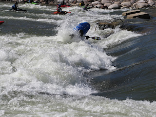
A kayaker in the Glenwood Whitewater Park
The Park at low water
With Colorado towns growing fat on the outdoor recreation industry, towns all over Colorado began to develop their own whitewater parks and freestyle kayak events. Successful whitewater parks were constructed in Gunnison, Lyons, Avon, Vail, Golden, and more. It seemed only natural that the at least one community in the boater-dense Roaring Fork Valley would follow suit. The years passed, however, and no progress was apparent.

In the middle of the first decade of the 2000’s, new energy reinvigorated the movement of the Glenwood Springs Whitewater Park, which had previously been stalled by concerns of the Hot Springs Lodge and Pool that any dredging on the basement rock during the park’s construction could adversely affect the hot springs aquifer and threaten their multi-million dollar property. An ad-hoc committee was officially appointed by the city and charged with seeing the project through to its conclusion. I was lucky enough to take part in the process during those final crucial years.

The committee consisted of about a dozen core members, consisting of local business owners, a smattering of kayakers of various ilk, and other non-boating members of the local population who, for whatever reason, took a shine to the dream of a whitewater park. Local engineer/hydrologist Jason Carey was brought in to the discussions. It was Jason and his partner Nick Turner who would ultimately do much of surveying for and designing of the whitewater park as it exists today. 

Since Two Rivers Park was deemed too close to the hot springs aquifer, a number of alternatives were considered, including Glenwood Canyon, South Canyon, numerous spots along the Roaring Fork River, and on the Colorado in West Glenwood just upstream or just downstream of the Midland Avenue Bridge. There were several key components that the committee was looking for in the site, and it seemed that none of the options had them all. The location had to have gradient, be accessible, have parking, be publicly owned, and have potential to draw visitors into Glenwood Springs to spend their money (otherwise what interest did the city or county have in paying for the park in the first place).

A kayaker in the hole at the Glenwood Whitewater Park at 4,000 cfs
The Park at 4,000 cfs
With its Gold Medal Fishing designation and abundant private property, the Roaring Fork River was eliminated early, despite its tremendous potential. We knew that to really maximize our investment the feature had to be built on the world famous Colorado River. No other artificial play wave had yet been built on the Colorado and admittedly we wanted to be the first. The only question was where.

We eliminated South Canyon next. Though there was great potential since the city owned the land and parking was plentiful, the committee decided that South Canyon was simply too far from town and would not draw in visitors to Glenwood Springs the way it potentially could.

Glenwood Canyon also had several strong possible locations and seemed more closely connected to town than South Canyon. However, access in the tight corridors of Glenwood Canyon ultimately made the logistics impossible. We turned our eyes to the only possibility that was left: West Glenwood. 

We scouted the West Glenwood location extensively in 2006 and 2007; originally thinking that downstream of the Midland Avenue Bridge was the most likely spot. Most of the hotels and restaurants in the vicinity were cooperative and enthusiastic about the project. Feeling we had found our location at last, we began the process of obtaining permits and seeking funding. 

The many months that followed were spent applying for grants and prodding city council and the Board of County Commissioners for money. After several failed attempts at a GoCo (Great Outdoors Colorado) grant, the City of Glenwood Springs, with some help from Garfield County, decided to invest whatever it would take to finish the complete the project. Now we had our location and our money and all that remained was to get our rocks down in that river.

Construction began at last in the winter of 2007/2008, one of the heaviest snow years in a decade. Eco-friendly oils and fuels were required for all machinery that entered the river. The feature was built in two halves and un-veiled in the early spring of 2008. When the resulting runoff from the heavy snow came, we watched in wonder as the feature we had conceived ran the spectrum of possible flows. While the original intention had been to build a wave that was good mostly at the target levels of 4,000 cfs and below, we discovered that the feature not only still worked above 4,000 cfs but that as the water came up the wave seemed to only get better. Many Roaring Fork Valley playboater burned hours upon hours that first year on the wave, excited with each new day to see how the feature changed. The river reached 8,000 and it turned from a hole to wave. At 10,000 it was a spinning, front surfing, roundhouse machine. By 12,000 the good boaters were getting full-on aerial tricks. Buzz circulated the freestyle scene and playboaters from all over came to see what it was all about. Some of the best playboaters in the world camped out in Glenwood for several long weeks.
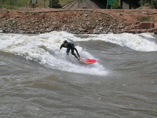
A surfer at the Glenwood Springs Whitewater Park
Surfing the Park at 15,000 cfs
Another pleasing surprise was the wave’s popularity with non-kayakers such as surfboarders and, a bit later, Stand-Up Paddleboaders. From the standpoint of those that invested their time, energy, and even money into the wave, it had never been a park just for kayakers. The fact that on many days kayakers are only a small percentage of the SUPers, surfers, and spectators present at the park is a sign of its success on a broader scale, which had been the goal from the beginning. 

 The river peaked that first season just over 20,000 cfs, toppling a few of the newly constructed boulders in the process. Corrections were made and the banks improved in subsequent years.

In the spring of 2009 the hype surrounding the park allowed Glenwood to win the bid for U.S. Team Trials for the 2010 World Cup team. The event was held at the new whitewater park in late May of 2009 at flows around 15,000 cfs. The town of Glenwood Springs later declined an invite to host the World Championships, citing a lack of necessary infrastructure to accommodate such an event at the site.

The runoffs of 2010 and 2011 were epic, boasting some of the highest and most sustained flows the valley had seen since the infamous record years of 1983 and 1984. 2011 was especially memorable. Late spring snows and cool temperatures kept the water high. The river peaked in late June at over 27,000 cfs through the park and stayed well over 15,000 cfs for almost three months. No matter how high the flows got, the wave only seemed to get better. As far as we have discovered, there is absolutely no level in which there isn’t some play at the Glenwood Whitewater Park.   

Sunday, March 25, 2012

DISTRACTIONS The Legend of South Canyon

The eddy was eerily silent. Memories, almost tangible in my mind, came sweeping to the forefront of my conscience. There were days not so far past when boats would line up at this very spot by the dozen, all jockeying for a turn to surf one of the Colorado River’s best play waves. The flow was 3,500 cfs. Three or four years ago this exact level would have brought kayakers from across the state.

South Canyon was once a king among surf waves. In the 1990s during the era of longer boats, you could sit on the wave for hours, gliding and carving across its dynamic face. As boats shortened with the coming of the new millennium, Southy (as it was affectionately referred) was the perfect place for dizzying flat spins and roundhouses. As kayaks became even shorter, we found that South Canyon was the perfect place to learn the new aerial tricks, blunts and helixes.

South Canyon’s golden age of freestyle pre-eminence lasted well over a decade. It was common for the wave, with its small window for good surfing, to be in for only a few days as flows came up and receded. South Canyon days were treated as special holidays, well worth a sick day from work or unexcused absence from school. We spent countless hours on those holidays trying and perfecting the latest tricks: right blunt, left bunt, helix, flip turn. But now, just a few short years later, the eddy had fallen silent. No cheers of glee. No eddyline chatter. No camera clicks or excited dogs barking. Just a lonely silence. What had happened?

In 2008 the Glenwood Springs Whitewater Park was constructed in West Glenwood. Although we didn’t yet know it, this was the beginning of the end for the Age of South Canyon. As the levels that summer spiked to near ten-year records, we were delighted to discover that our new wave—the product of over ten years of hard work—only got better as the water came up. Above 10,000 cfs the whitewater park formed something unprecedented in Colorado: a wide, fast, tall, and bouncy big water surf spot. The new wave not only overshadowed South Canyon but anything else in the state. It was consistent, easy to access, and allowed a variety of tricks with the ability to easy link them without washing out.

When the river reached that critical window the first season, the boating crowd was divided between the new whitewater park and old Southy. Some paddlers still clung to the old hero. But highwater in 2010 and again in 2011 (the latter reaching a 27-year high of 27,000 cfs) altered South Canyon forever. No longer did the wave hold its classic shape. The death of the King was complete.    

Now, as age and two decades of experience have begun to catch up with me, it has become easy to slip into the “you should have been there when…” rhetoric of the old timers. But sitting in the eddy at South Canyon at 3,500 cfs, remembering when this exact level would have seen the parking lot three-cars deep with excited boaters, it was hard to fight off the memories and turn to those too young or too new to the sport and start to talk about what used to be.

Monday, January 23, 2012

FLOW GUIDE Colorado River in Glenwood Canyon


Glenwood Canyon Flow Guide

0 to 2,000 cfs Low
Very common level during the summer, fall and early spring seasons. Grizzly is mellow (II) though shallow in spots, Shoshone is straightforward (III), and Barrel is mostly dry due to the diversion.

2,000 to 5,000 cfs Medium
Banks starting to fill in. Popular and fun level. Grizzly is deeper and pushier but still manageable by a strong beginner. Shoshone is getting juicy and starting to show a little muscle, especially above 4,000 cfs. Long swims and flipped rafts are possible. Barrel is filled in a pushy. This is the level in which most Barrel descents occur. Class V around 3,000 cfs and up.

5,000 to 10,000 cfs High
Now we’re talking! Only the biggest rocks are still exposed. Grizzly has some surprising waves and powerful currents (III), Shoshone is pushy class IV with some ugly, well-spaced monster holes, and Barrel is top-expert V+.

Above 10,000 cfs Very High
Yee-haw! Monster waves and very strange currents throughout. Only experienced paddlers should attempt even the easy sections. Grizzly is pushy and swirly (III), Shoshone is starting to flush but has gigantic moments and brutal consequences (IV), and Barrel is utterly heinous. How high can it get? In 2011 the river peaked just under 19,000 cfs. In both 1983 and 1984, the two highest water years on record, the river peaked over 20,000 cfs.

Wednesday, December 7, 2011

COLORADO RIVER Dotsero to Bair Ranch

Put-inDotsero Boat Ramp            
Takeout    Bair Ranch
Length6 miles
Difficulty< 2,000 cfsI+
2,000-5,000 cfsI+
5,000-10,000 cfsII
> 10,000 cfsII
Special Beta: Put your noobs here!

Fun Factor:
Fear Factor:

If there ever was an ideal section of river for a first river experience, it is this one. Smooth, calm corners, huge deep eddies, and two or three minor wave trains define this run. For a beginner, especially one that is on the timid side, this is the perfect place to start. As opposed to many Colorado class I’s, this section is deep, making it safer for the bottomside-top beginner.

The put-in for this section is at the dirt boat ramp just upstream of the I-70 bridge in Dotsero (river left). This adds 3 miles of calm water and the section’s most difficult rapid (I+ at most levels). A shorter run, however, can be had by driving downstream from the Dotsero exit along Highway 6 to the trailhead at the east end of the Glenwood Canyon Bike Path. This abridged version has the best eddies and two good riffles (I+) but loses the best rapid.

Although this section is great for beginners at most flows, very high water (over 10,000 cfs) some dangerous currents form.

Tuesday, November 22, 2011

COLORADO RIVER Barrel Springs

Put-inHanging Lake            
Takeout    Shoshone (or Grizzly Creek)
Length2.2 miles (3.6 miles to Grizzly)
Difficulty< 2,000 cfsIV+ (P)
2,000-5,000 cfsV- (VI-)
5,000-10,000 cfsV (VI-)
> 10,000 cfsVI-
Special Beta: Colorado big water with roadside access!

Fun Factor:
Fear Factor:


The hardest, most dangerous rapid on the entire Colorado Rier lies not in the famed Grand Canyon or the depths of Cataract Canyon or Westwater or even Gore Canyon, but here in Glenwood Canyon only a few minutes drive from Glenwood Springs.

Formerly known as Kayaker’s Nightmare, and considered unrunnable, these days this infamous rapid, re-christened Upper Death, has been downgraded to V+ and is run with some regularity. In my opinion, Upper Death is worthy of tipping into the VI- to VI grade. Regardless of the class rating, it is a very serious drop and infrequently ran. It is quite possibly the hardest rapid in the Roaring Fork Valley.

This section of river, often called “Barrel”. Is plagued by unfortunate logistical problems that have undermined its reputation as a premier, cutting-edge, big water run. First, the put-in and takeout are only accessible from the eastbound lanes of I-70, which makes the shuttle annoyingly complicated. Second, when I-70 was constructed the signature rapid was hidden under a bridge from interstate viewers, reducing the “siren” effect that such a magnificent rapid can have. Third, and most important, the diversion at Shoshone Dam pulls the teeth of the river here, rendering it dry for much of the season. Despite this, Barrel still offers some of the only big water hair boating in Colorado and is a very worthy run for the expert kayaker.

After working through Barrel’s unique logistical issues, carry your boat down the bike path past Shoshone Dam to the crux rapid, Upper Death. It is not worth putting in in-between the dam and falls.

Barrel Springs Rapid on the Colorado River near Glenwood Springs, Colorado
Barrel Springs Rapid
Upper Death is a serious rapid at all levels, and probably unrunnable at certain water levels. The rapid is a three-tiered cascade with a large, steep ramp at the bottom with a powerful hole studded with ugly rocks in the froth. A cave on the left halfway down the rapid and an undercut at the bottom on the right further increases the danger of the line. The rapid deserves a V+/VI- rating depending on the flow.

A short pool separates Upper Death from its unruly stepchild Lower Death. At the lowest runnable levels you can paddle around and warm-up in the pool between the two, but usually it’s a rocket blast start into some immediate cruxy moves. IV+ at its easiest, Lower Death gets harder as the water comes up. Lower Death is full-on class V at medium to high levels.

A mile and a half of intermittent II/II+ lands you in the pool above Barrel Springs, the namesake drop and an area classic.

Pioneered in the early 80’s by paddlers like Matt Gaines and Kevin Padden, Barrel is a rapid of preeminence in the Roaring Fork Valley. Though the rapid has undergone numerous topographical changes, it is a long and difficult rapid usually rated IV+ to V- at low to medium levels, thus it is not as cutting edge as it used to be. At high water, however, Barrel is full-on class V+ with dangerous consequences. Even the best boaters will be challenged at these levels. I have been with world-class playboaters who passed on Barrel over 5,000 cfs.

Barrel is a long rapid, and its continuous nature add to its difficulty. The crux moves come in the top third, which is often called the “S-turn”. Depending on the flow, a big hole backed up by some sharp rocks or turbulent laterals will give you pause. Some people choose to put-in below the S-turn crux and only paddle the “Dogleg”, the long curving runnout that ends in a move right to avoid an ugly hole/roostertail (IV/IV+). At lower levels and exciting center line exists.

Below the Dogleg, the river eases but still remains turbulent, crashing through a rapid I have always called “Lower Barrel” or “Post-Barrel” (III+/IV). After a couple of corners the river calms and you may be tempted into thinking the difficulties are over. But alas, one more tricky drop exists. Just around the corner and out-of-sight from the powerplant and boatramp at the Shoshone Powerplant is a sneaky, sharp drop that cannot be seen from the interstate. The hole here is violent and deceptive. A somewhat straightforward sneak exists but you must be much further left than it appears from above, or risk being typewritered into the stickiest spot (IV-).

Monday, October 17, 2011

COLORADO RIVER Shoshone

Put-inShoshone Powerplant            
Takeout    Grizzly Creek
Length1.6 miles
Difficulty< 2,000 cfsIII
2,000-5,000 cfsIII+
5,000-10,000 cfsIV
> 10,000 cfsIV+
Special Beta: Colorado big water with roadside access!

Fun Factor:
Fear Factor:

At regular levels Shoshone is one of Colorado’s benchmark class III runs. Seen by millions and paddled by many, Shoshone is one of the busiest stretches of river in the state. Very few, however, would likely call Shoshone their favorite.
         
As a long-time local paddler who has paddle Shoshone more times that I could ever count and at almost every level between 400 and 10,000 cfs, I have a certain fondness for this run; it is where I honed many of my skills. Shoshone does, however, have a few detractors that keep it from being a classic. First, length. At just over a mile and half, Shoshone is simply too short. Second, visibility. With a bikepath, train tracks, and a four-lane interstate, it is often hard to remember how amazing and beautiful Glenwood Canyon is. The noise pollution is tremendous. Third, this run is busy. Hoards of boats do Shoshone and the sheer volume of rafts and kayaks can change the nature of your day. Shoshone does have some things going for it, however, that make up for some of its shortcomings. It has deep, quality class III whitewater with ample opportunities for play (though none too amazing). It has consistent flows that keep it running when all else has gone dry. It is a great place for the skill-advancing intermediate to sharpen their kayaking teeth and learn skills necessary for more technical whitewater. These factors alone will always guarantee this run’s
Shoshone on the Colorado River
The All Day Wave on Shoshone
popularity.

After putting in at the boat ramp below Shoshone Powerplant, you paddle a short riffle (II) to a huge eddy on river right above the first rapid, Baptism (III-/III+). Before I get into describing the rapids themselves, it is worth noting a fact or two about said rapids’ names.

The name game in Shoshone is a complete mess. While each of the rapids, and even some of the individual holes, rocks and even eddies, have been named, there seems to be a great deal of confusion about these names. Kayakers might call a rapid one thing and rafters might call the same drop by yet another moniker. Certain rapids might have two or more differing names depending on who you talk to. This first rapid, for example, is usually called Baptism (III-/III+), but I have also heard it called Upper Superstition in certain guidebooks. Oh well, I will try to note this discrepancies as I go along.

Baptism is a straightforward rapid with a large wave train at the top that widens into runnout that is peppered by holes or rocks depending on the level. This rapid merges into the next at medium and high levels.

The river bends hard right below Baptism and enters Tuttle’s Tumble (III/IV), which I have also heard called Lower Superstition. Tuttle’s features a large table rock in the center of the river that forms a big and trashy hole above 4,500 cfs or so. A river-right chute is the usual route around this obstacle. Move either left or right below Tuttle’s to avoid two off-set rocks at low water (the Olsen Twins) which turn into a huge, trashy hole at higher levels (Marty’s Diner). Immediately below Marty’s is a rocky runnout called Pinball Alley (II+/III) with a few sharp moves around small but troublesome rocks/holes. A big eddy on the left below provides a good place to stop before the next rapid.

Next up is The Wall (III/IV) one of the more distinct and fun rapids of the run. While almost everyone agrees that this rapid is called The Wall (named for a retaining wall on river left) I have seen it listed as China Wall in several publications. The river bends right through The Wall and crashed through a series of big waves and holes. Most boats enter left to miss two ledgy holes and pull right to miss a rock/hole at bottom-left of the drop. The slot between the two holes at the top is also a common gate for entry and shortens the pull right, making it especially popular for heavy rafts. Many rafts have flipped, however, flubbing this entry move and dropping into either of the two holes. Above 4,000 cfs these holes are powerful. Above 8,000 cfs they are basically washed out.

Below The Wall is a large eddy on river left followed by a short drop that forms a surf wave at lower levels. This drop is often called the All-Day Wave by kayakers, a named from a different era that seems almost comical now. In the days of the 8-foot playboat we used to front surf/flat spin here for hours. Nowadays it’s probably only good for a carve or two before moving on. I have heard this rapid called Bonehead and even, ugh, Upper Superstition in certain circles. This short class II is washed out above 3,000 cfs.

Below the All-Day Wave the river constricts and bends slightly left through a short rapid sometimes called Lower Superstition. I prefer to think of this rapid as the first part of Tombstone, as problems here often lead to problems in Tombstone immediately downstream. At higher water the two drops are intimately connected. A huge crashing wave forms here above 4,000 cfs or so and the undercut formed by the bikepath at high water on the right is a particularly dangerous place for swimmers.
A raft on Tombstone Rapid

In my opinion, Tombstone (III+/IV) is the crux rapid of the run, and the only one where everyone seems to agree on the name. A tall, sharp rock left of center distinguishes the hardest move. This rock combine with a steep pourover/hole to its right barrs easy passage. At low water rafts generals go right of the hole and cut back left to miss a pesky pinspot. Kayakers, on the other hand, usually take a whooshing slot between the tombstone and the hole and avoid the pinspot completely. At high water you must wiggle between two very large holes. The pointed rock starts to go under at about 6,000 cfs.

After Tombstone the river calms in a large pool sometimes called Cottonmouth Alley by raft guides. At highwater the river remains fast through here. The last rapid, Maneater (III/IV) has a reputation as the run’s hardest, but in truth it's straightforward. This reputation comes from the fact that some of the biggest waves of the run are found here. Maneater is straightforward to run, however, and flushy. A flip here should deposit you in calmer water downstream, making this one of the better places to experience carnage. Busting a big wave 2/3rds of the way down keeps the commercial rafters wet and smiling. A large ledge hole far left above 5,000 cfs is probably this rapid's most dangerous hazard. Unfortunately, Maneater was listed as Superstition Rapid in Dave Eckhardt and Gordon Banks 2nd edition of Colorado Rivers and Creeks.

Below Maneater a half mile of easier water (II-) brings you to the popular Grizzly Creek boatramp.

Friday, August 26, 2011

COLORADO RIVER Two Rivers to South Canyon

Put-inTwo Rivers Park            
Takeout    South Canyon Boat Ramp
Length6 miles
Difficulty< 2,500 cfsII+ (III-)
2,000-5,000 cfsII+ (III)
5,000-10,000 cfsIII
> 10,000 cfsIII+
Special Beta: Colorado big water with roadside access!

Fun Factor:
Fear Factor:

The section from Two Rivers Park at the confluence of the Colorado and Roaring Fork Rivers down to South Canyon below town is more urban, industrial, and quieter than the runs in Glenwood Canyon. Compared to the Grizzly section upstream, South Canyon generally has fewer, but slightly bigger rapids. As of the spring of 2008 it also has the Glenwood Spring Whitewater Park, a manmade wave that is best at highwater but offers play opportunities at every level. The 2009 U.S. Freestyle Kayak team trials were held here.

Immediately downstream of Two Rivers Park the river crosses under a tall bridge with dangerous but easily avoided columns. After another long, calm stretch alongside a railyard, the river bends left through an easy riffle (II-/II) Not far downstream the river splits around an island and drops through a lengthy rapid (II/II+). A couple of nice beaches and the private boat ramp belonging to Whitewater Rafting are just downstream on the left.

There are several warning signs regarding the whitewater park, informing boats to “scout/portage” on the right. In reality, for a properly managed boat, there shouldn’t be any reason to do either. Negotiating the whitewater park, in fact, is no more difficult than negotiating South Canyon Rapid not far downstream. The structure is just upstream of the large road bridge in West Glenwood near the West Glenwood on-ramp. If you are feeling uneasy about the whitewater park, give it a quick scout before starting the run. It is a fun place to hang out anyway, with grassy, tiered seating, a few benches, and some large rocks. The only downside is the lack of available parking.

The hole/wave itself has caused some problems for boats, particularly in its first year when people weren’t yet accustomed to running it. Right of center is the worst spot, where medium and high water brings the most powerful and trashy part of the wave. Make sure to stay far right to avoid the worst of it (II+/III-)
Below the whitewater park the river starts to leave Glenwood behind and enter South Canyon. You are now also entering the burn area of the 2002 Coal Seam Fire. The remains of the 1994 Storm King Fire, which killed 14 firefighters, are also visible. Now, years later, many of the signs of those two important days in Glenwood Springs’ history are starting to be erased. A few easy corners will take you past a wastewater treatment facility and to the top of a long, straight rapid just as you leave town. This rapid is best taken left of center at almost every level to avoid a couple of sleepers which turn into big holes at medium levels (II+/III). A couple of easier riffles come in quick succession below this rapid (II).

After a calm stretch the river bends right into “Upper South Canyon,” a wave train with some fun laterals and big rollers (II+). A fast, flat section greets boaters below this rapid and the black, iron bridge at South Canyon comes into view.

South Canyon is the crux rapid of the run. It is a large wave train with big laterals and crashing whitecaps. At higher water a bridge pylon river right can cause some problems for an off-line or swamped boat. A huge eddy on the left adjacent to the rapid and an even bigger one on the right at the bottom aid in cleaning up any carnage you might experience. These features help minimize any protracted hardships and keep the grading of the rapid to a manageable III-/III. One more straightforward rapid (II/II+) leads to the boat ramp on the right.

Tuesday, July 19, 2011

COLORADO RIVER South Canyon to New Castle

Put-inSouth Canyon           
Takeout    New Castle
Length6 miles
Difficulty< 2,500 cfsII+
2,500-5,000 cfsIII-
5,000-10,000 cfsIII
> 10,000 cfsIII+
Special Beta: Colorado big water with roadside access!

Fun Factor:
Fear Factor:

This novice/intermediate section of river is even less frequently paddled than Two Rivers to South Canyon above it. Despite this, however, it is a worthy run for the advanced beginner or intermediate paddler. Mellow water peppered with several stiffer corners define this run.

Below the boatramp at South Canyon you enter a long, calm stretch good for warming up. The canyon is tight here and you are still in the burned-out remnants of two major forest fires (the 2002 Coal Seam and the 1994 Storm King). After the calm straightaway the river bends right into a long, mellow riffle (II-/II) with some big rocks along the right bank. The river calms below this drop and bends left. A horizon line emerges in front of you marking a short, steep drop sometimes called Landslide (II+/III-) Mudslides after the Storm King Fire added rocks to the river here, making the rapid significantly harder. A chute on the right is obstructed by large crashing waves at high water and the left is steep and hard to see over. Several possible chutes exist as well as several holes that could munch an offline kayaker or tuber.

The action is short-lived and the river mellows below this point. A dangerous railroad bridge, however, just above the confluence of Canyon Creek is treacherous at highwater. The best way is not always obvious from above, but most boaters split the two pylons.

South Canyon Wave on the Colorado River in South Canyon
Surfing South Canyon circa 2004
Below the bridge Canyon Creek enters on the right (possible river access). Two mellow but interesting rapids follow, one with a surprising hole at low water that seems to draw inexperienced boaters like a magnet (II+). After this the river calms as it passes under the former site of a pipe bridge long used by local high school kids for jumping. A few years back the old pipe bridge fell into the river. The river bends right below here into a stout riffle we used to call “Jurassic Park” for its proximity to Dinosaur Hole (II/II+).

Said Dinosaur Hole is a short ways downstream next to a fenced-in Dinosaur Quarry. The quarry contains a stegosaurus but was fenced off due to the presence of low-grad radioactive material. The rapid is short but contains a monstrous hole in the center above ~10,000 cfs. Most boaters skirt the hole to the right where big waves form at high water (II/III). Tibbets Landing, a popular river access, is just downstream on the right.

Below Tibbets, the river becomes even more mellow. While much of this section is highly visible from I-70, this stretch is even less-frequently paddled. The river bends right below Tibbets and enters a long riffle with some basement rock ledges about midway down that form some ledgy waves at medium levels (II/II+). A long calm stretch follows.

After going underneath a bridge in New Castle, the river enters one last rapid immediately above the takeout. This tricky drop has some medium-sized hole in the main channel and some sneaky rocks to avoid (II+). The takeout is at a boat ramp just downstream.


Friday, January 21, 2011

RIVER BASIN The Mighty Colorado


Introduction


The Mighty Colorado River


     The Mighty Colorado River needs no introduction. It is the most famous river of the American Southwest and is lifeblood for nearly seven states. In terms of history of whitewater boating there are few rivers that are more important than the Colorado. This fame, of course, comes largely from the pioneers of the Grand Canyon and the history that occurred there. The section of the Colorado concerned within this book, between Dotsero at the headwaters of Glenwood Canyon and New Castle at the base of South Canyon, have also played their role in shaping whitewater history and Colorado boating history. Although this section of the Colorado River suffers from over-exposure with I-70, several other roads, and a popular bike path closely mirroring it for its entire length through this section, it plays an important role for the Colorado boating community, for it is one of the only rivers with year-round reliable flow. As a result boaters from all over the state often come to Glenwood Canyon and the Glenwood Springs area during the off and shoulder seasons.

All things considered, the boating in Glenwood Canyon is outstanding. Sure it could be better in some ways. It could have more class V, more class IV, more class III, less class II, more play, less rafts, whatever it is that people might complain about. But the truth is that boaters of almost every level can find something for them in Glenwood Canyon. It might not be the best at anything but it has a little of everything. Rank beginners can learn eddy turns on the deep, forgiving waters and well-defined gentle eddies of the upper canyon. So-called ‘”advanced beginners” can hone new skills on the forgiving class II waters of Grizzly and South Canyon. Intermediates can train on Shoshone and do laps while they prepare for better things. With two short portages, advanced boaters can run all but the crux of Barrel at a manageable class IV level. And experts can catch Barrel at high water for some full-on big water class V. While the noise of I-70 so close by can be a distraction, it is hard to deny the beauty of Glenwood Canyon.

In the 21st Century life has improved for the boater on the Colorado in this area. The addition of the whitewater park eases in the congestion of Shoshone and creates more options for fun park and play for kayaks and other surfers. With its terraced grass seating and benches it also makes for a fun place to have lunch and watch the kayakers and surfers.